Wilderness Tamed: Erhard Etzlaub, Imperial Forests around Nuremberg (1516)
Abstract
Erhard Etzlaub (c. 1455–1532) was a cartographer, compass maker, and medical doctor who lived and worked in Nuremberg. In the first years of the sixteenth century, Nurembergers began using maps as tools in their conflicts with neighboring princes, and Etzlaub was one of the cartographers at the forefront of this new conceptualization of space (cf. his This is the Road to Rome map for an example of precise distances). Although the image here is not a map, it depicts the extent of the forests surrounding the city, presenting them as simultaneously formidable and yet also tamed through logging.
Source
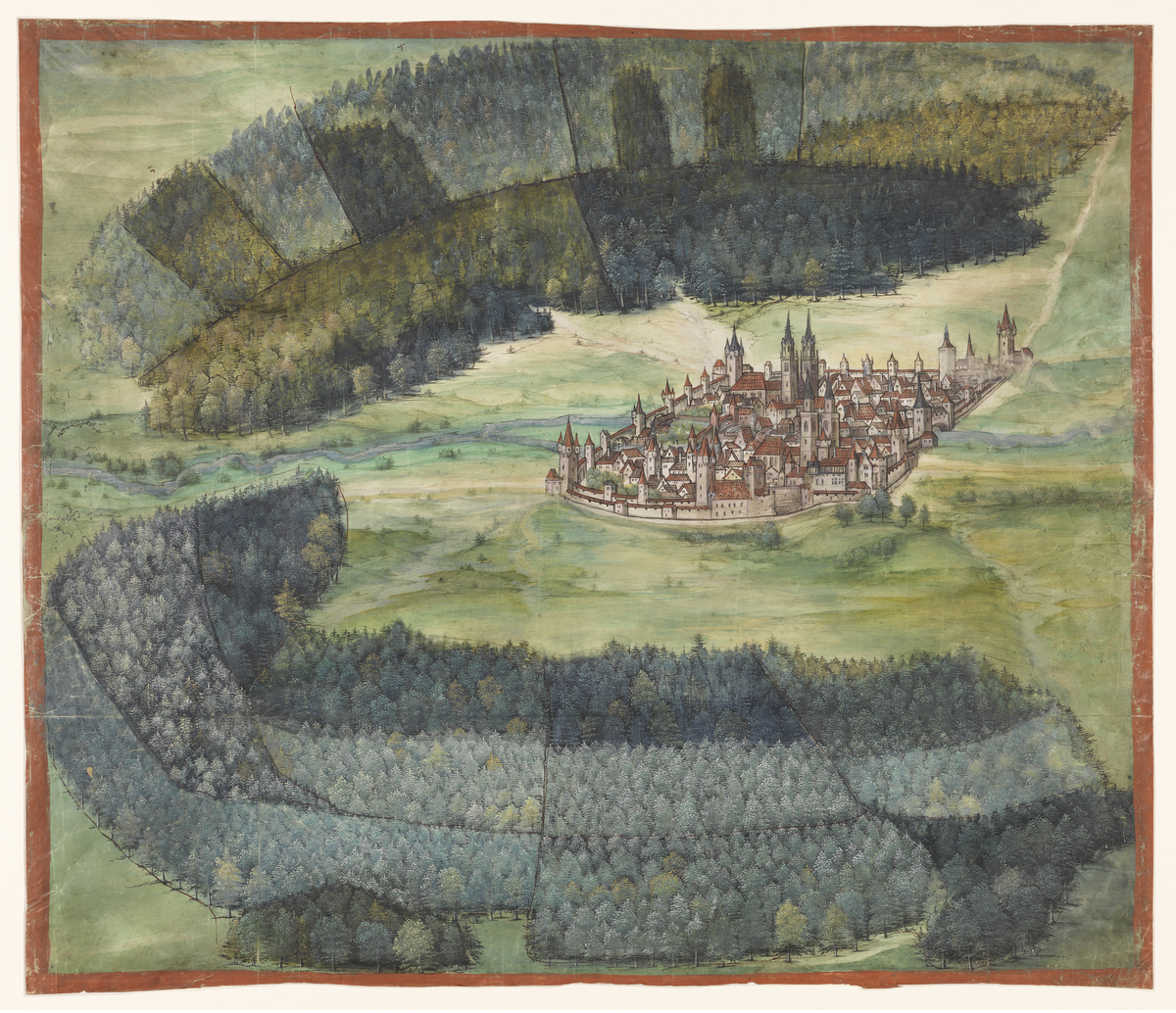
Source: Erhard Etzlaub, Waldplan von Nürnberg [Imperial Forests around Nuremberg], 1516. Materials/technique: opaque paint on parchment. Germanisches Nationalmuseum Nuremberg, Inv.-Nr.: SP10419. Available online at: http://objektkatalog.gnm.de/objekt/SP10419.
Image reprinted in: Christopher Wood, Albrecht Altdorfer and the Origins of Landscape (1993). Revised and expanded second edition. London: Reaktion Books, 2014, p. 152.
Germanisches Nationalmuseum Nuremberg. Photo: Georg Janßen.
Further Reading
August Oretegel, “Zum Nürnberger Waldplan von 1516,” Mitteilungen des Vereins für Geschichte der Stadt Nürnberg, Bd. 57 (1970), pp. 232–41.
Fritz Schnelbögl, “Leben und Werk des Nürnberger Kartographen Erhard Etzlaub (gest. 1532),” Mitteilungen des Vereins für Geschichte der Stadt Nürnberg, Bd. 57 (1970), pp. 216–31.
Christopher Wood, Albrecht Altdorfer and the Origins of Landscape (1993). Revised and expanded second edition. London: Reaktion Books, 2014, p. 152.